Interlaken
Goldswil Church Ruin Hike: A Free 680m Viewpoint
T
Timoté Baily
Author
September 9, 2026
14 min
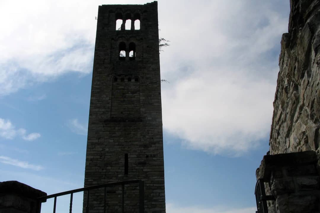
Stand on the Höheweg and look northeast, past the roofs, up the wooded slope on the far side of the Aare. There is a square stone tower up there. Most people take it for a chapel and never think about it again.
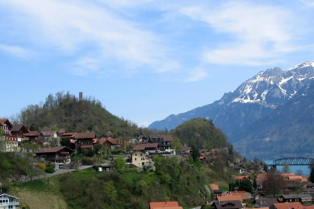
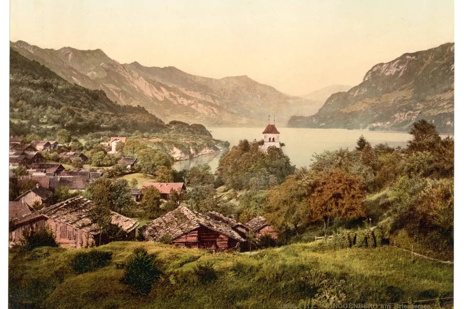
It is a campanile. An Italian bell tower, built between 1050 and 1080, on a rock spur at 680 metres, and it is the oldest standing structure you can see from the centre of Interlaken.
You can walk to it in an afternoon. There is no gate, no ticket, no opening time, and on most days nobody else. The panorama from the churchyard covers the whole Bödeli, the mouth of the Aare, and on a clear evening both lakes at once.
The catch is that everything written about it in English runs to about 180 words. The real story sits in a canton of Bern archaeology flyer, in German, that has never been translated. Here it is, with the route.
What is the Goldswil church ruin?
The remains of St. Peter, a parish church begun on the Kirchhubel above Goldswil in the 10th or 11th century, abandoned in 1671 and left to fall down. Its free standing bell tower still stands 16 metres high. The site is open, unfenced and free at all hours.
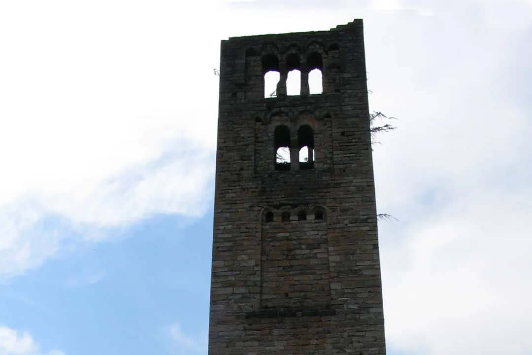
This was not a village chapel. St. Peter was the mother church of a huge parish that covered Goldswil, Ringgenberg, Niederried, Unterseen, Habkern and Beatenberg-Waldegg. Everyone in that arc walked up this hill to be baptised, married and buried.
Two stone slab graves found on the hill are older than the first church, which puts a burial ground here in the 8th to 10th century, before any building went up.
What survives today is the tower, 16 metres high after losing its top belfry storey, the outline walls of the church, the two storey charnel chapel on the northeast side, and the churchyard wall. The canton of Bern restored the whole site between 2015 and 2017.
How do you get to the Goldswil church ruin from Interlaken?
By bus in four minutes, then on foot. PostBus line 102 leaves Interlaken Ost at :08 and :38 past every hour and reaches Goldswil, Dorf in four minutes. From the village the marked footpath climbs the Kirchhubel. Walking the whole way from Interlaken Ost takes considerably longer than the twenty minutes the internet claims.
The bus is the sensible answer. Line 102 runs Interlaken Ost to Ringgenberg and on to Niederried, all year, every 30 minutes, and Goldswil Dorf is the stop you want.
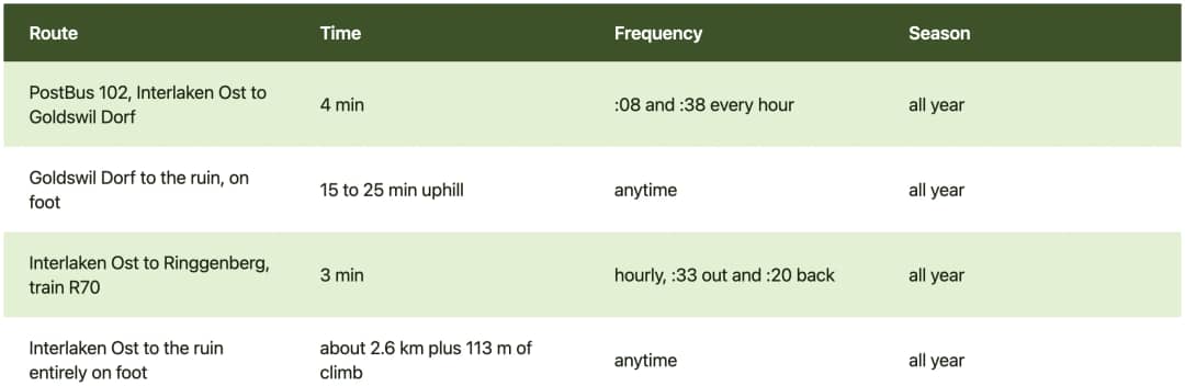
Bus and train times taken from the official Swiss public transport timetable, checked on 26 August 2026.
There is a car park on the through road in Goldswil, at the foot of the hill, and a second one further along toward Ringgenberg. The canton's own route description starts from the Goldswil car park and climbs the west side.
Now the number everybody repeats and nobody has walked. Several English pages say the ruin is "just 20 minutes by foot from the Interlaken Ost train station". From the station to the churchyard is roughly 2.6 kilometres with 113 metres of climb, from 567 metres at the platform to 680 metres at the ruin. Twenty minutes is a run, not a walk.
How hard is the climb to the Kirchhubel?
Short and steeper than it looks. From 618 metres in Goldswil village to 680 metres at the churchyard, so about 62 metres of climb over a few hundred metres of path. The west side is a graded footpath with switchbacks. The east side, coming from Ringgenberg, is what the canton's flyer calls a narrow footpath.

Two ways up, and they are not equivalent:
From the west, out of Goldswil village. A comfortable made path, a few switchbacks, and you enter the churchyard from the west exactly as people did in the Middle Ages. This is the way up for anyone with knees, children or a dog.
From the east, off the Katzenpfad. A narrow foot track. Fine in dry weather, greasy after rain, and not a pushchair route.
Honest verdict on effort: this is a walk, not a hike. No exposure, no scramble, no equipment. If you can manage the stairs up to the Harder Kulm terrace, you can manage this. The one thing to respect is the surface, because roots and worn rock take over on the last stretch.
The ruin itself is uneven ground. Grass, old wall footings, and no railings around the church outline. Watch small children near the wall stubs rather than near a drop, because the drop is not the hazard here, the trip hazard is.
What can you actually see from the top?
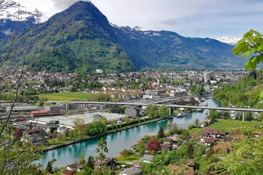
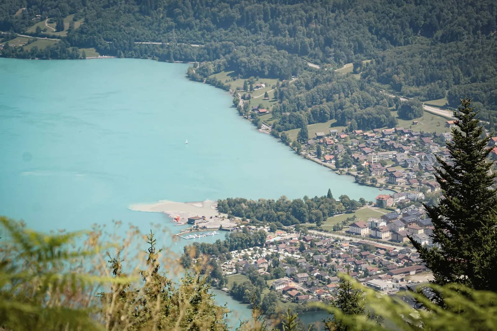
The whole Bödeli, the flat plain between the two lakes, laid out southwest of you. Interlaken, Unterseen, Matten, the Aare running out of Lake Brienz, the Lombach delta, and behind them the wall of the Beatenberg ridge. Turn and Lake Brienz opens northeast, turquoise, with the Brienzergrat above it.

The geometry matters if you carry a camera. The hill sits northeast of Interlaken, so the town lies into the afternoon and evening sun, and the tower's west face takes the last light. Morning puts the sun behind the ruin and gives you a silhouette, which is a picture, just not the picture most people came for.
What you can pick out on a clear day, working left to right from the churchyard: the Niesen's pyramid over the Thun end, the Beatenberg terrace, the Harder Kulm platform sticking out of the trees almost level with you, the Aare bend at Interlaken Ost, and the near end of Lake Brienz with the Burgseeli in its bowl below.
The words travellers keep using for this spot are "a very epic mountain top location" and "probably the coolest ruin of the Interlaken area", which is more enthusiasm than a 62 metre climb usually earns. They are not wrong about the view.
One thing to know before you plan a picture around it. The tower is hollow and open at the base, and copies of the two carved figures stand inside the lowest storey. You cannot climb it. There is no staircase and no platform in the Goldswil tower. For a tower you can climb, that is Ringgenberg, twenty five minutes along the ridge.
Why is there an Italian bell tower above Lake Brienz?
Because this valley traded with Lombardy. The free standing tower at Goldswil is a campanile, a north Italian form, and the canton of Bern calls it unique in the canton. Only the plainer and probably younger towers of Brienz, Meiringen and Steffisburg stand anywhere near it. Lombard craftsmen may have worked on it.
Towers like this line the alpine and pre alpine trade routes between Ticino and Burgundy. The canton's flyer reads it as a landmark visible from far away and a sign of the power of the nobles who built it.
Look at the decoration and the argument makes itself. Tall blind niches with round arched friezes break up the wall faces. Bevelled cornices carry plant and animal ornament. Carved impost blocks with stylised animals sit in the twin and triple openings of the belfry storeys.
Then there are the two figures that have nothing Christian about them. Two male atlantes once stood in place of piers on the east side of the upper storeys, hands raised protectively beside their heads. Folk belief tied figures like these to protection, strength and possibly fertility. Christian symbolism and pagan superstition on the same wall, high on the tower.
The originals are not on the hill. They sit in the municipal building in Goldswil, and what you see in the tower base are copies. Almost nobody who visits knows this, because it is written in one line at the bottom of a German flyer.
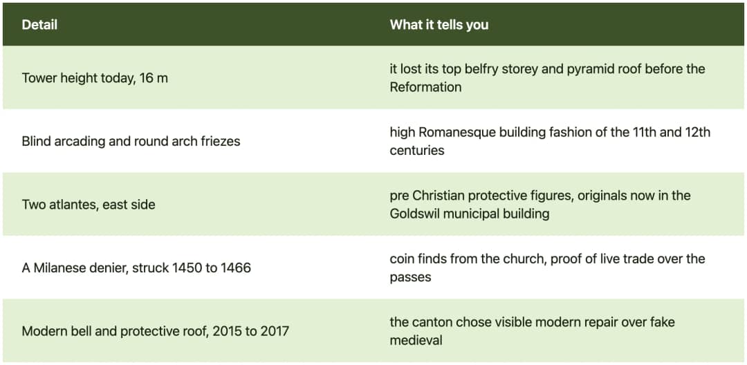
All figures from the canton of Bern Archaeological Service flyer on the Kirchenruine Goldswil, 2017 edition, read on 26 August 2026.
Can you walk the loop to Ringgenberg castle?
Yes, and it is the best version of the day. A signed circular route links the Goldswil church ruin to the Ringgenberg castle ruin, 1.3 kilometres apart, by way of the Katzenpfad, a former beacon site and the shore of the Burgseeli. Information posts stand at both ruins and around the lake.

Walk it in this order and the day builds properly:
Goldswil car park to the church ruin. Up the west path, into the churchyard from the west, and around the outside of the old parsonage ruin on the south slope.
Down the east side to the Wachtfeuer. A narrow foot track drops off the hill, then the signed path runs above the east shore of the Burgseeli through open woods and meadow. The short detour to the old beacon site is worth the ten minutes.
On to the Burgfelsen. You see the Ringgenberg castle rock from a long way off, which is exactly the effect its builders paid for.
Back along the west side of the Burgseeli to Goldswil, past the bathing area and its nature reserve panels.
The connecting path is called the Katzenpfad, the cat path, which tells you what width to expect. It is a walking trail, not a promenade.
About the Burgseeli itself. It is a moor lake at 613 metres, 5.25 hectares, up to 19 metres deep, and it warms up far more than Lake Brienz ever will. Swimmers say "the water is warmer than in other lakes" and "beautiful small swimming lake in the middle of a nature reserve". Where to swim around Interlaken, and at what temperature, belongs to our guide to the lakes around Interlaken, which measures them month by month.
For the castle at the far end of the loop, its burnt lords and the baroque church built inside the walls, that is a story of its own and it has its own guide to the Ringgenberg castle church.
When should you go, and what does the light do?
Late afternoon, and any month. The ruin never closes and costs nothing, so the season only decides what else is open. The natural lido on the Burgseeli runs 12 May to 20 September 2026. The trees on the hill are beech and maple, so late October and November strip the view open and May gives you the clearest air.
"I go up for sunset."
Timoté Baily, mountain photographer at Swiss Local Adventures
Bus 102 leaves Interlaken Ost at :08 and :38 and reaches Goldswil Dorf in 4 minutes.
Month by month, what actually changes on this hill:
April and May. Bare branches, long views, cold rock. The best months for photographing the tower's carving, because no leaves stand between you and the wall.
June to August. Full green, hazy afternoons, and the Burgseeli open 09.00 to 20.00 with water reaching 26 degrees in a hot spell. The hill stays empty even in August, which is the strange part.
September and October. The pick. Warm stone, low sun onto the west face of the tower, and the lido still open to 20 September.
November to March. Nothing is open and the view is at its widest. Bus 102 runs all year. The east track off the Katzenpfad turns slick in frost, so go up and down the west path in winter.
On weather, this is a rain resistant outing in one specific way. Cloud light flatters carved stone, and the blind arcading on the tower reads better without hard midday sun on it. What rain does ruin is the east descent, which is earth and roots.
Your questions about the Goldswil church ruin
Is the Goldswil church ruin free to visit?
Yes, completely. The site is freely accessible, unfenced, with no ticket, no gate and no opening hours. The canton of Bern restored it between 2015 and 2017 and Interlaken Tourism asks only that visitors respect the monument and leave it as they found it. There is no staffed presence, no shop and no toilet on the hill, so bring what you need. The nearest facilities are in Goldswil village at the foot of the path, and at the Burgseeli lido during its season.
How old is the church ruin at Goldswil?
The first stone church went up on the Kirchhubel in the 10th or 11th century, and burials on the hill are older still, with two stone slab graves dating to the 8th to 10th century. The free standing bell tower followed around 1050 to 1080, and the church was rebuilt with a west porch around 1100. That makes the tower more than 900 years old.
Can you climb the tower at Goldswil?
No. The Goldswil campanile has no staircase, no gallery and no viewing platform. You can walk into the open base of the tower, where copies of the two carved atlantes are displayed, and that is as far as it goes. The originals of those sculptures sit in the municipal building in Goldswil. If you want a tower you can climb, walk the 1.3 kilometres on to Ringgenberg, where the castle tower has been open by stairs, gallery and a viewing terrace since 2008.
Why was the church moved from Goldswil to Ringgenberg?
Bern built a new church inside the ruins of Ringgenberg castle in 1670 and 1671, and services moved there from 1671. The buildings on the Kirchhubel lost their purpose and fell down, and usable stone was carried away. The cemetery followed in 1695 and the minister finally moved house in 1729. That staggered move is why some tourism pages say the church moved in the 18th century and the canton's chronology says 1671. Both are describing the same slow abandonment.
Is the Goldswil church ruin worth it with children?
Yes, with two conditions. Take the west path out of Goldswil village, which is a graded footpath with switchbacks and about 62 metres of climb, rather than the narrow east track. Then watch feet rather than heights on the summit, because the ruin is open ground with low wall stubs and grass, and the trip hazards are at ankle level. The whole outing works well combined with the Burgseeli lido below, which has a shallow basin, a pirate ship and water far warmer than Lake Brienz.
Where is the best free viewpoint over Interlaken without a cable car?
This hill is a strong candidate. At 680 metres it stands about 113 metres above the Interlaken Ost platform and looks straight down the length of the Bödeli, with the Aare, both towns and the Beatenberg ridge in one frame, and Lake Brienz behind you. It costs nothing, has no queue and no closing time, and the walk up from the Goldswil bus stop is short. The Harder Kulm platform is higher and sits almost level with you across the valley, but it costs a funicular ticket and closes at night.
A tower worth the detour on a busy day
I photograph this region for a living and I still find it strange that a thousand year old Lombard tower sits above the busiest tourist town in the Alps with nobody underneath it. Four minutes on the 102, a short climb, and you have the whole valley to yourself.
Go late in the day, take the west path up, and give yourself the twenty five minutes along the ridge to Ringgenberg afterwards. That walk holds two ruins, a warm lake and a view that costs nothing.
For more free viewpoints and short outings, see things to do in Interlaken, summer in Interlaken and our best day trips from Interlaken. For a swim after the climb, start with the guide to the lakes around Interlaken.
If you want a day around Lake Brienz built out of the parts nobody queues for, we can plan a private day around it, or message us on WhatsApp.
Source: Ruined church at Goldswil, Interlaken Tourism, Kirchenruine Goldswil flyer, Archaeological Service of the Canton of Bern, Ringgenberg-Goldswil archaeological sites, Canton of Bern, Naturstrandbad Burgseeli and the Swiss public transport timetable, all checked on 26 August 2026. Elevations measured against the Swiss federal height model, swisstopo, 26 August 2026.
Written by Timoté Baily, your mountain photographer at Swiss Local Adventures
Tags
#church-ruins#medieval-history#short-hikes#interlaken-viewpoints#lake-brienz-day-trip#interlaken-day-trips
Sources & References
- •Interlaken Tourism, Ruined church at Goldswil
- •Archaeological Service of the Canton of Bern, Kirchenruine Goldswil flyer
- •Canton of Bern, Ringgenberg-Goldswil archaeological sites
- •Naturstrandbad Burgseeli
- •Burgseeli, German Wikipedia
- •Swiss public transport timetable, search.ch
- •swisstopo, federal elevation model
- •Photo: Rectilinium on Wikimedia Commons
- •Photo: Rectilinium on Wikimedia Commons
- •Photo: Rectilinium on Wikimedia Commons
- •Photo: Rectilinium on Wikimedia Commons
Share this article
Similar Articles
Continue your reading with these related articles
Interlaken
9/12/2026
12 min
9
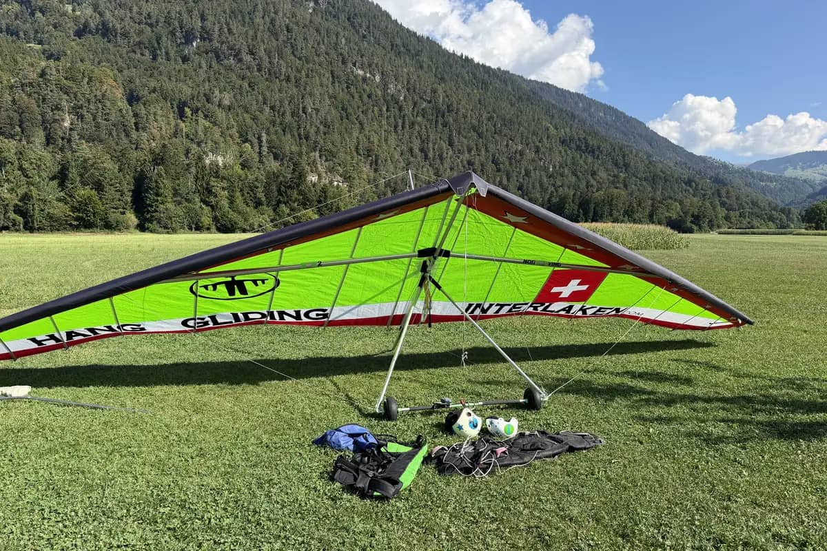
Hang Gliding or Paragliding in Interlaken?
Compare hang gliding and paragliding in Interlaken: same hill, same 20 minutes, CHF 170 against CHF 260. Here is what the extra 90 francs actually buys.
tandem-hang-glidingtandem-paraglidingadventure-sports
By Timoté BailyRead More
Interlaken
9/11/2026
15 min
12
Bönigen Historic House Trail: Free, 4 Min Away
Walk Bönigen's free historic house trail, four minutes by bus from Interlaken Ost, past carved wooden houses standing since 1549. Times and map inside.
historic-house-trailday-trip-brienzinterlaken-day-trips
By Pierre VetschRead More
Interlaken
9/8/2026
15 min
12
Ringgenberg Castle Church: Built Inside a Ruin
Bern built a church inside the burnt ruin of Ringgenberg castle in 1670. What survives, when it opens and how to visit free from Interlaken.
castle-churchcastle-ruinsswiss-history
By Olivia LufmanRead More