Interlaken
Oberhornsee Hike: 1,243 m Up From Stechelberg
P
Pierre Vetsch
Author
September 29, 2026
13 min
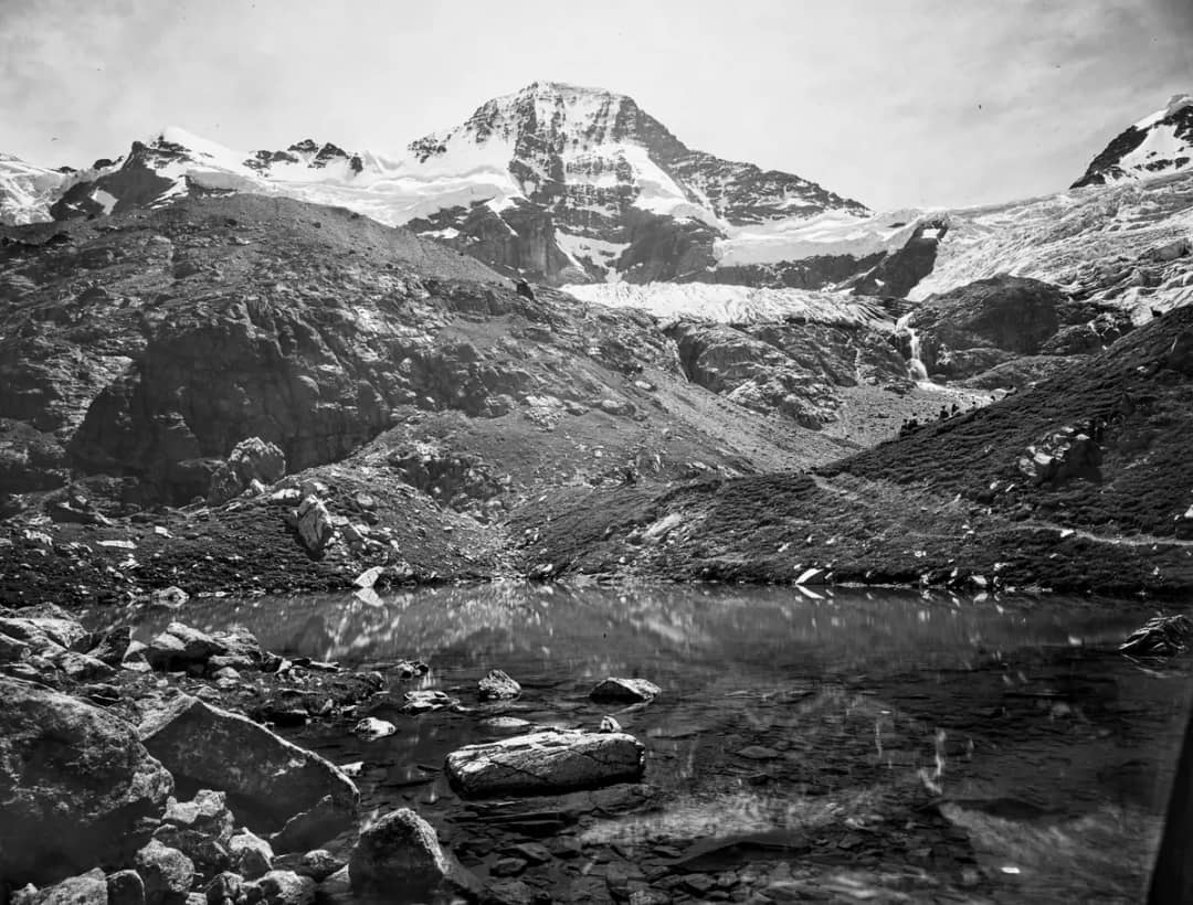
The Oberhornsee is a small lake at 2,065 metres, tucked into a hollow behind a moraine, with the glaciers of the Breithorn straight across the water. Most people who visit Lauterbrunnen never hear its name. On AllTrails, the loop that reaches it has about 60 reviews, while the Bachalpsee above Grindelwald has 2,950.
I have walked all the way from Stechelberg to the lake. No gondola goes up there, and no crowd waits at the top. There is the lake, the ice in front of you, and a handful of other hikers.
This guide covers whether the climb is worth it for you, how to reach the trailhead, the route stage by stage, the two trail closures in force this autumn, where to stop for lunch, how it compares with the Bachalpsee, and when to go. Every time, altitude and closure below was checked at the official source on 29 September 2026.
Is the Oberhornsee hike worth the climb?
Yes, if you are fit and you start early. The official route from Stechelberg climbs 1,243 metres over 8.3 km to a glacier lake at 2,065 metres, inside a nature reserve with no lift of any kind. You earn every metre, and in return you get the quietest mountain lake in the Lauterbrunnen valley.
When people ask me what makes it worth a whole day, my answer is always the same.
Pierre says: "The Oberhornsee itself, the glaciers right in front of you, and only a few hikers."
Pierre Vetsch, founder and head guide at Swiss Local Adventures
The numbers explain the quiet. Lauterbrunnen Tourismus rates the route moderate and gives it 4 hours one way, with 1,243 metres of ascent and 214 metres of descent. The whole back of the valley has been a cantonal nature reserve since 1960, and the inns up there are reached on foot. The waterfalls on the valley floor, which most visitors come for, are covered in the 72 waterfalls of Lauterbrunnen.
The lake is small, and it is not always full. It has no direct inflow: meltwater from the Breithorn glacier feeds it underground, according to World Heritage Experience Switzerland, and its level drops towards autumn. It has dried out completely in the past, and the same source says this has become more pronounced in recent decades.
How do you get to Stechelberg, and when should you start?
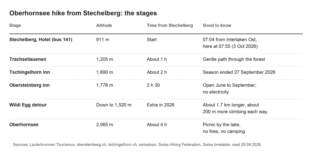
Take the train to Lauterbrunnen, then bus 141 to the end of the road. On Saturday 3 October 2026, the 07:04 from Interlaken Ost reaches the Stechelberg, Hotel stop at 07:55, a 51-minute trip with one change. Be on that bus or the next one: the day is long, and the daylight runs out before the buses do.
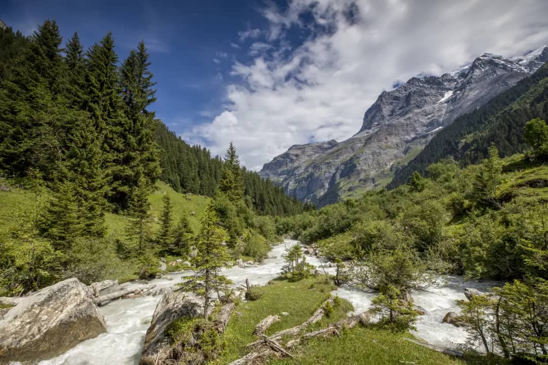
I know this trailhead well: I have brought groups to the end of the road in Stechelberg several times.
Trains leave Interlaken Ost at :04 and :34 and take 22 minutes to Lauterbrunnen. From the station forecourt, bus 141 takes 20 minutes to Stechelberg, Hotel, where the trail begins. Coming back on the same date, buses leave Stechelberg, Hotel at 17:00, 17:30, 18:05 and 18:35, then every hour at :05 into the night.
By car, the Tschingelhorn inn sends hikers to the gravel car park next to the Hotel Stechelberg. The meter takes coins only and prints two tickets: one goes behind the windscreen, the other can be redeemed at the hotel. If you have not chosen where to sleep yet, Lauterbrunnen or Interlaken as a base weighs the two, and the cable car from the same car park is covered in how to get to Mürren.
What is the route from Stechelberg to the Oberhornsee?
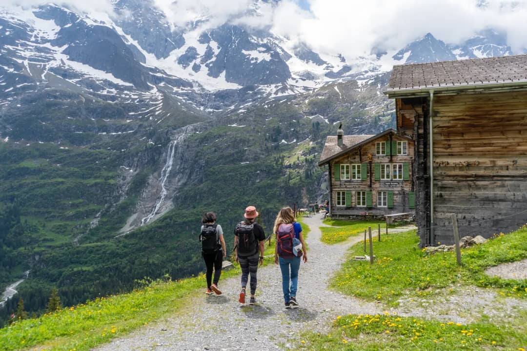
Four stages, all uphill. From Stechelberg, the path follows the valley through forest to Trachsellauenen at 1,205 metres, climbs past the Tschingelhorn inn, reaches the Obersteinberg inn at 1,778 metres, then crosses open ground to the lake at 2,065 metres. Lauterbrunnen Tourismus puts the whole climb at four hours, before this year's detour.
My own way up follows the same line.
Pierre says: "I go up through Trachsellauenen and come back down the other side of the valley."
Pierre Vetsch, founder and head guide at Swiss Local Adventures
The first hour is the gentle part. Lauterbrunnen Tourismus describes the path as rising gently through the forest to Trachsellauenen. The Tschingelhorn inn gives about two hours from Stechelberg to its door and about one hour from Trachsellauenen, which leaves roughly an hour for this first stage. After Trachsellauenen the path gets steeper, and it stays that way.
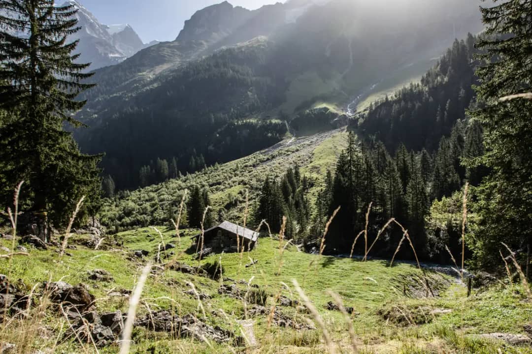
The Obersteinberg inn says its guests reach it in a two-and-a-half-hour mountain walk from Stechelberg. Beyond it, the official description has the last section cross open terrain to the lake, under the steep, partly icy north faces of the Grosshorn and the Mittaghorn. Since the route totals four hours, count about an hour and a half from Obersteinberg to the Oberhornsee.
Reviews on AllTrails keep returning to the same points: very steep from the start, steep in both directions, and wooden planks that turn slippery in the rain. Several reviewers also insist on sun protection and waterproof shoes.
Which trails are closed in the back of the valley in 2026?
Two, and one of them is on the way to the lake. The federal register of hiking-trail closures, read on 29 September 2026, lists the direct path from Obersteinberg towards the lake and a path on the other side of the valley as closed until further notice. A marked detour keeps the lake within reach.
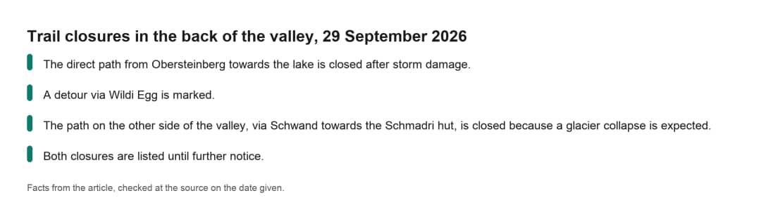
These are the entries as the Swiss Hiking Federation publishes them on the federal map. The direct path from Obersteinberg towards the lake is closed after storm damage. A detour via Wildi Egg is marked. The path on the other side of the valley, via Schwand towards the Schmadri hut, is closed because a glacier collapse is expected. Both closures are listed until further notice.
The detour has a cost. Measured on the federal elevation model, it runs about 2.8 km instead of 1.1 km and drops to about 1,520 metres before climbing back: roughly 200 metres of extra climbing in each direction. Lauterbrunnen Tourismus also marks its own Oberhornsee route as closed, because it passes through an inaccessible area.
It changes my advice for this year. The second closure is on the other side of the valley, where my loop comes back down. Until it reopens, do the hike as an out-and-back: up through Trachsellauenen and Obersteinberg, the Wildi Egg detour to the lake, and the same way down. Check the federal trail closure map the evening before you go, because entries change.
Obersteinberg, Tschingelhorn or a picnic at the lake?
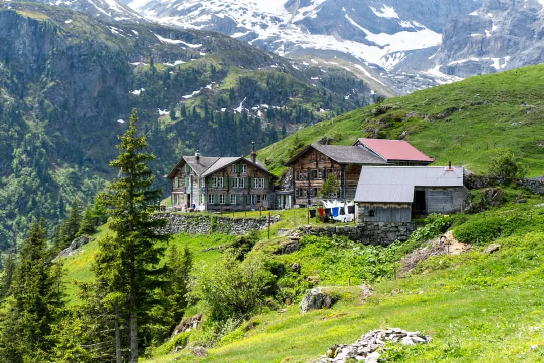
A picnic at the lake. Both inns sit on the way up, and both close for the winter: the Tschingelhorn inn's season ended on 27 September 2026, and Obersteinberg opens only from June to September. I eat at the Oberhornsee itself, with the glaciers in front of me, and I skip the inn.
Most hiking guides send you to Obersteinberg for lunch. I do it differently.
Pierre says: "A picnic at the lake, no inn."
Pierre Vetsch, founder and head guide at Swiss Local Adventures
Obersteinberg is still worth a look as you pass. The inn has no electricity, and its 12 double rooms have no running water: guests wash from basins and jugs. It also has a 30-bed dormitory, takes reservations by phone only, and asks overnight guests to bring a torch, slippers and cash in Swiss francs. The Tschingelhorn inn, built more than 150 years ago, sits a little lower at 1,690 metres. Its owners have a Bernese word for the view up there: «Gottsärdeschön», Bernese for stunningly beautiful.
A picnic comes with rules. The whole area is a nature reserve, and Pro Natura, which owns the land around the lake, asks visitors to keep dogs on a leash, light no fires, not camp, and take their rubbish home. The full rules are on the Pro Natura Bern reserve page.
Fun fact: In 1947, Pro Natura bought the Untersteinberg alp with the money raised by its Schoggitaler, a chocolate coin campaign. In 1960, the canton of Bern placed the whole back of the Lauterbrunnen valley, about 26 km², under protection. The Oberhornsee still belongs to Pro Natura.
Oberhornsee or Bachalpsee: which mountain lake is for you?
The Bachalpsee if you are not fit, the Oberhornsee if you are. The Bachalpsee above Grindelwald sits about 100 metres above the First gondola station, and AllTrails lists the walk there as 6.4 km return with 222 metres of climbing. The Oberhornsee asks for 1,243 metres from the bus stop. That gap decides it for most people.
I don't hide the Bachalpsee from people who ask me.
Pierre says: "The Bachalpsee for people who aren't fit: easier, a superb view, iconic, but a lot of people."
Pierre Vetsch, founder and head guide at Swiss Local Adventures
The review counts tell the same story about crowds. On 29 September 2026, AllTrails showed 2,950 reviews for the walk from First to the Bachalpsee and 60 for the Oberhornsee loop from Stechelberg. Swisstopo puts the Bachalpsee, which the national map calls the Bachsee, at 2,266 metres, higher than the Oberhornsee at 2,065 metres. The gondola does that climbing for you.
My verdict: if you can walk uphill for four hours, go to the Oberhornsee and keep the Bachalpsee for a day with less time or tired legs. If you are comparing lakes across the region, the Oeschinensee above Kandersteg is the other one people weigh against these two.
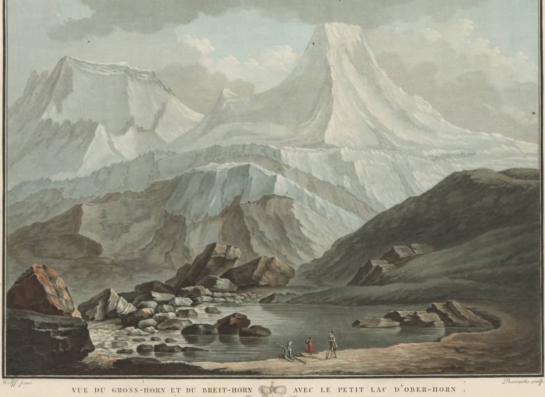
The lake has been on paper for more than two centuries. An engraving after the painter Caspar Wolf, published between 1785 and 1794 and now held by the Swiss National Library, already shows the little lake under the Grosshorn and the Breithorn.
When can you go, and how fit do you need to be?
From June to September, once the snow has gone, and only if you hike regularly. Snow can linger on the upper path into early summer, and the lake level drops towards autumn. With 1,243 metres to climb, plus the detour this year, this is a full mountain day, not a walk for young children or occasional walkers.
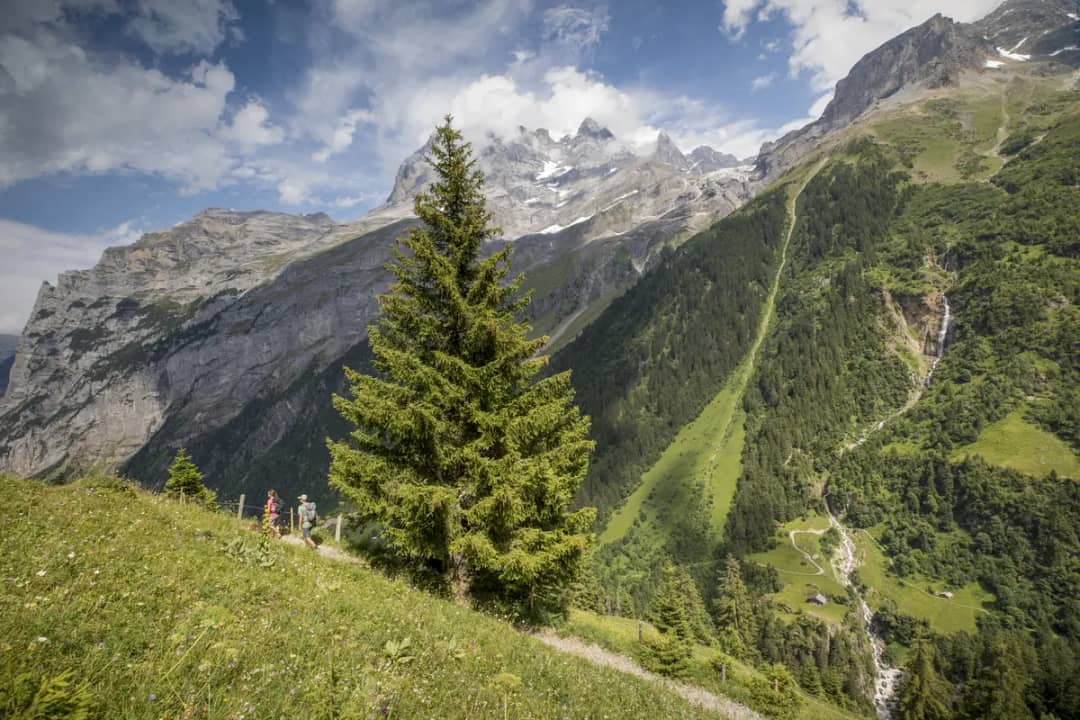
The season is short, and I tell people when it works.
Pierre says: "It works all summer, from June to September, once the snow has gone: good temperatures and good visibility."
Pierre Vetsch, founder and head guide at Swiss Local Adventures
Early summer is the risky end. A hiker who went at the end of May 2026 advised on AllTrails against continuing past Obersteinberg, because of melting snow over deep ravines, exposure and the risk of rockfall. At the other end, from October both inns are closed, so everything you eat and drink comes up in your pack.
The fitness side is simple arithmetic. Four hours and 1,243 metres up, the same back down, and about 200 metres more each way on this year's detour. That is a long day on steep ground, and the second half is the descent, when tired legs slip.
Insider tip: People underestimate the climb and start too late. Bring water too, and a few small snack bars.
I don't recommend it to families with young children, or to people who don't walk often or aren't in good shape. For them, the flat valley path between Stechelberg and Lauterbrunnen shows the waterfalls without the climb, and our day trip guide to Lauterbrunnen plans the rest of the day.
Your Questions About the Oberhornsee Hike
The short answers: plan a full day, since the official climb alone takes 4 hours. The lake can shrink or dry out in autumn. Dogs are allowed on a leash, while camping and fires are not. The inns close at the end of September, so from October you carry your own food and water.
How long does the Oberhornsee hike take?
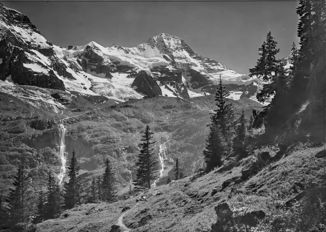
Lauterbrunnen Tourismus gives 4 hours from Stechelberg to the lake, for 8.3 km and 1,243 metres of ascent, and its route comes back the same way. In 2026, add the Wildi Egg detour, about 1.7 km more and roughly 200 metres of extra climbing in each direction. AllTrails lists an 18.2 km loop via the Schmadri hut with 1,504 metres of elevation gain, but part of that loop is closed this year. Take an early bus from Lauterbrunnen and plan the whole day.
Does the Oberhornsee dry out?
It can. World Heritage Experience Switzerland writes that the lake has no direct inflow and is fed underground by meltwater from the Breithorn glacier. Because the glacier has shrunk a lot, it now drains almost entirely into the Schmadribach, and the lake has shrunk with it. Its level drops towards autumn, and it has dried out completely before. Pro Natura, the owner, looked at channelling extra water to the lake and decided against any construction.
Can you bring a dog on the Oberhornsee hike?
Yes, on a leash. The back of the Lauterbrunnen valley has been a cantonal nature reserve since 1960, and Pro Natura asks visitors to keep dogs on a leash throughout. Think about the terrain too: reviewers on AllTrails describe steep sections in both directions and wooden planks that get slippery in the rain. Your dog needs the fitness for 1,243 metres of climbing, just like you.
Can you camp at the Oberhornsee?
No. Pro Natura's rules for the reserve say no camping and no fires, and ask you to take your rubbish home. If you want to sleep up there, the Obersteinberg inn opens from June to September, with 12 double rooms and a 30-bed dormitory, and it takes reservations by phone only, on +41 33 855 20 33. It has no electricity and no running water in the rooms, so bring a torch.
Are the mountain inns open in October?
No. The Tschingelhorn inn's 2026 season ran from 23 May to 27 September, and the Obersteinberg inn opens from June to September. We could not confirm the season of the Trachsellauenen inn, whose website did not load on 29 September 2026. In October, carry all your food and water up with you.
Hike the back of the valley with a local
The simplest way to do this hike well is to go with someone who has walked it. Our custom private tours are built around what you want to see, with a private local guide, groups of up to eight and free cancellation. We handle the logistics, plan around the closures and walk at your pace.
The Oberhornsee worries people for three reasons: the climb, the closures and the planning. A 07:04 train, a bus to the end of the road, a detour that follows the federal map, and inns that shut at the end of September. A guide takes that part off your hands.
If you want to stand at a glacier lake with almost nobody else there, design your private day with us. Tell us your fitness and your dates, and we will tell you whether the Oberhornsee is the right hike, or whether the Bachalpsee suits you better.
Source: Lauterbrunnen Tourismus, Oberhornsee route, the federal register of hiking-trail closures, and guided days in the Lauterbrunnen valley with Swiss Local Adventures.
Written by Pierre Vetsch, founder and head guide at Swiss Local Adventures
Tags
#hiking-interlaken#lauterbrunnen-valley#mountain-lake-hike#swiss-alps-summer#nature-reserve-switzerland
Sources & References
- •Lauterbrunnen Tourismus, Oberhornsee route (Outdooractive), read 29.09.2026
- •Swiss Hiking Federation, trail closures on the federal map, read 29.09.2026
- •Berghotel Obersteinberg, read 29.09.2026
- •Berggasthaus Tschingelhorn, info and 2026 season, read 29.09.2026
- •Pro Natura Bern, Hinteres Lauterbrunnental nature reserve, read 29.09.2026
- •World Heritage Experience Switzerland, Oberhornsee, read 29.09.2026
- •Swiss public transport timetable, 3 October 2026, read 29.09.2026
- •Photos: Jungfrau Region Tourismus AG, CC0 (David Birri, Daniela Kläusler)
- •Photos: Photoglob-Wehrli and Caspar Wolf (Collection Gugelmann), Swiss National Library, public domain, via Wikimedia Commons
Share this article
Similar Articles
Continue your reading with these related articles
Interlaken
9/28/2026
11 min
7
Isenfluh Sledding: The Egg Cable Car to Sulwald
A CHF 16 cable car for 8 people or one cow, a forest run with nobody on it: a guide's plan for Isenfluh sledding and snowshoeing.
sledding-interlakensnowshoeing-interlakenlauterbrunnen-valley
By Pierre VetschRead More
Interlaken
9/26/2026
10 min
27
Wengen or Mürren? Wengen in Summer, Mürren in Winter
Wengen is 13 minutes closer to Interlaken and quieter at night. A local guide on where to stay, and why winter flips the answer to Mürren.
where-to-stay-jungfraulauterbrunnen-valleycar-free-villages-switzerland
By Pierre VetschRead More
Interlaken
9/25/2026
12 min
25
Is Gimmelwald Worth Visiting? Yes, for an Hour
Since December 2024 the fast cable car to Mürren skips Gimmelwald. A local guide on why you should still stop for an hour, and sleep in Mürren.
lauterbrunnen-valleycar-free-villages-switzerlandmurren-day-trip
By Pierre VetschRead More