
Stechelberg to the Oberhornsee
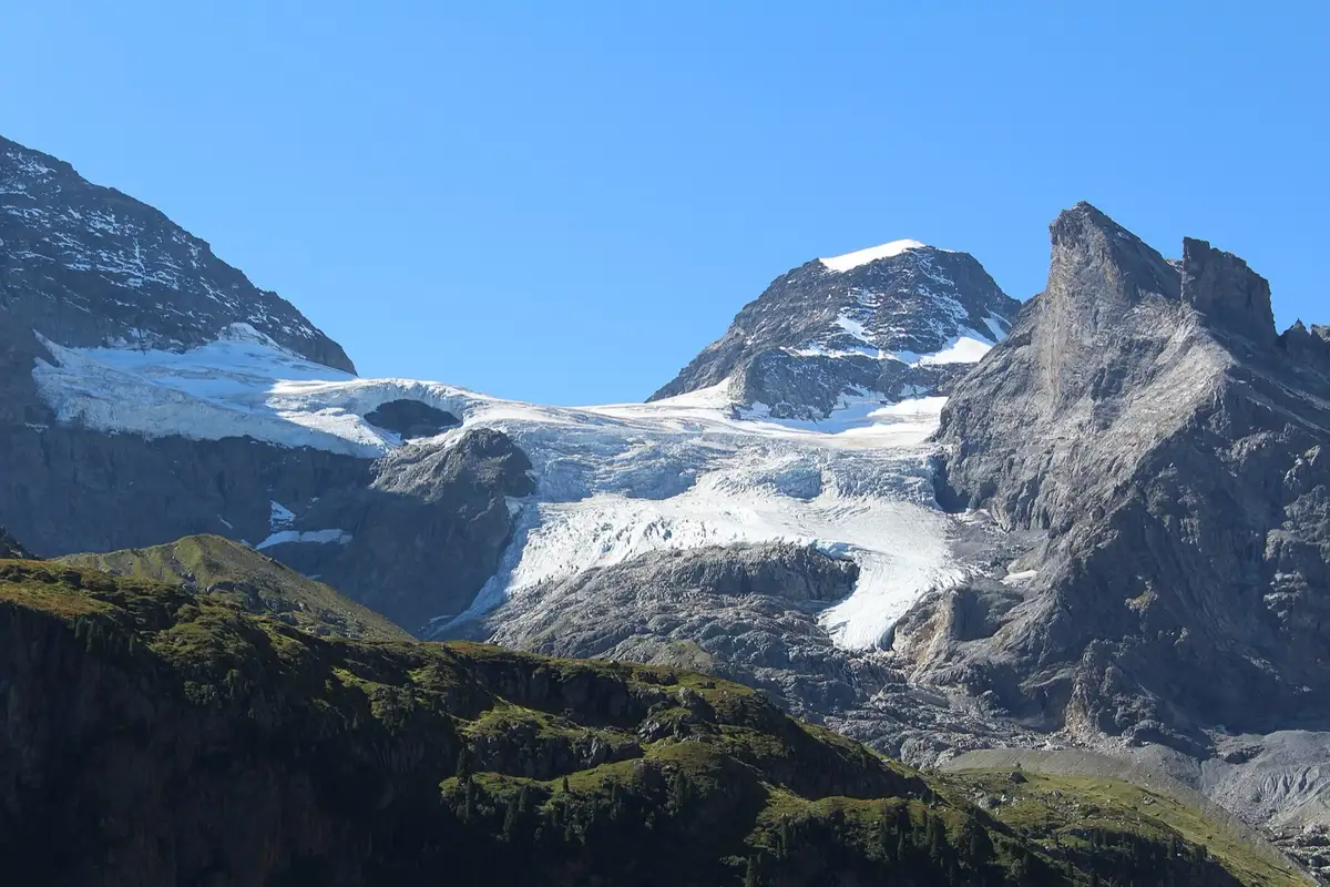
A long climb to a small lake at 2,065 m, with the glaciers of the Breithorn across the water.
Plan your dayHard · 4 hours upPlan itTrail closures: On 4 November 2026, Lauterbrunnen Tourism listed this route as closed. In autumn 2026 the direct path from Obersteinberg to the lake was closed after storm damage, with a marked detour via Wildi Egg. Check the federal map of closed trails before you go. Closed trails map ›
A summer hike: This one is on our summer list. Switch to Summer above, or see our winter hikes. Winter hikes ›
Trail closures: On 4 November 2026, Lauterbrunnen Tourism listed this route as closed. In autumn 2026 the direct path from Obersteinberg to the lake was closed after storm damage, with a marked detour via Wildi Egg. Check the federal map of closed trails before you go. Closed trails map ›
Quick facts
Highlights
About this hike
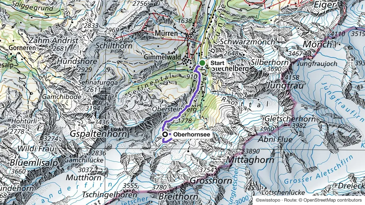
The path climbs through the forest to Trachsellauenen, then past the Obersteinberg mountain hotel, and crosses open ground to the lake. No lift goes up there.
The whole back of the valley is a nature reserve. The lake has no stream running in, so its level drops towards autumn.
Route map
How do I get to Stechelberg?
Take the train to Lauterbrunnen, then bus 141 to the Stechelberg, Hotel stop at the end of the road. Start early: it is a long day.
- Interlaken Ost to LauterbrunnenTrain, every 30 min22 min
- Lauterbrunnen to Stechelberg, HotelBus 14120 min
Train and bus times from the Swiss public transport timetable, read on 4 November 2026. Check the SBB app on the day. Bus time for 10 November 2026.
Good to know
Before you go
Can I do it?
- Level: Hard
- Footwear: For mountain trails, good shoes with grip. For valley walks, trainers are fine.
Stechelberg to the Oberhornsee: quick answers
How long is the climb from Stechelberg to the Oberhornsee?
8.3 km one way and about 4 hours up, with 1,243 m up and 214 m down. You come back the same way.
Is the trail to the Oberhornsee open?
On 4 November 2026, Lauterbrunnen Tourism listed this route as closed. Check the federal map of closed trails before you go.
When can I go?
From June to September, once the snow has gone.
Need a guide?
Want a local with you? Tell us your date and your group. We tell you honestly if we can guide this one, or which trail we would pick for you.
Teona, ski guide and farm tours, lives in InterlakenAsk Teona on WhatsAppMore hikes and huts
Lauterbrunnen, our local guide ›Oberhornsee hike: our full guide ›Hikes from Lauterbrunnen ›
See all hikes and huts