
Bernese Oberland
Iseltwald to Giessbach hike
Lakeside and forest trails from the south shore of Lake Brienz.
How do I get there?16 to 21 min by bus from Interlaken OstThe lakeside path from Iseltwald to Giessbach Falls is the walk people come for: 5.36 km in about 1 h 30, graded easy by Interlaken Tourism, almost all of it along the water. Iseltwald is 16 to 21 minutes from Interlaken Ost by bus. Walk out and take the boat back from Giessbach See while boats run, until 6 December 2026.
Written by Pierre Vetsch, founder and head guide. Last checked 11 November 2026.
Hiking in Iseltwald at a glance
- Iseltwald to Giessbach: 5.36 km, about 1 h 30, easy
Interlaken Tourism, read 10 Nov 2026 - Best season for it: May to October
Interlaken Tourism, read 10 Nov 2026 - Boat back from Giessbach See: Until 6 December 2026, then from 26 March 2027
BLS timetables, read 10 Nov 2026 - Walks in every month: The Senggflueweg and the panorama route
Interlaken Tourism, read 10 Nov 2026
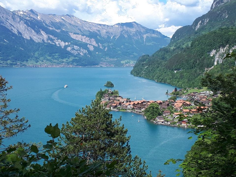
Hikes from Iseltwald, with official times
Six hikes below, from the easy lakeside path to Giessbach, 5.36 km in 1 h 30, to the difficult day up to the Bättenalp, 20.04 km in 7 h, June to October. Times and grades come from Interlaken Tourism and the Bernese Hiking Trails, read on 10 November 2026.
- The first half of the Three Waterfalls trail, Bönigen to Iseltwald, has its own trail page, linked below.
Lakeside path, Iseltwald to Giessbach
Easy, 5.36 km, 1 h 30From the lido, a gravel path follows the shore with slight ups and downs and some harder shoreline sections, 20 m up and 32 m down. A picnic spot waits halfway, and the municipality lists fire places at Gloota and Schnabler on the way. The municipality also gives about 1.5 hours.
Iseltwald to GiessbachMap ©swisstopoForest path, Giessbach to Iseltwald
Easy, 8.63 km, 2 h 50The quieter path higher up the slope, from the Grandhotel Giessbach through forest clearings back to Iseltwald: 370 m up, 470 m down. Fine with an off-road pram. Best from May to August.
The forest pathMap ©swisstopoSenggflueweg
Easy, 4.75 km, 2 hA loop from the village square on yellow signpost no. 2, up to the Senggflue view over the peninsula and the small snail island, then past the Mülibach waterfall. 170 m up.
The SenggfluewegPhoto: Bönigen-Iseltwald Tourismus, CC BY-SA 4.0Iseltwald panorama route
Medium, 11.51 km, 3 h 25A loop from the village square through Fura to the Isch, where the view runs over Interlaken to Lake Thun. 353 m up, highest point 916 m.
The panorama routePhoto: Bönigen-Iseltwald Tourismus / Interlaken Tourismus, CC BY-SA 4.0Path of the Three Waterfalls
Medium, 18.20 km, 5 h 15From the boat station at Bönigen, through Iseltwald and Giessbach, to Brienz: 466 m up and down. Our trail pages split it in two at Iseltwald.
Iseltwald to BrienzMap ©swisstopoTo the Bättenalp
Difficult, 20.04 km, 7 hA long mountain day from the village square, up to 1,937 m and back: 1,391 m up and down. Interlaken Tourism rates the fitness needed as very difficult, and marks June to October as its season.
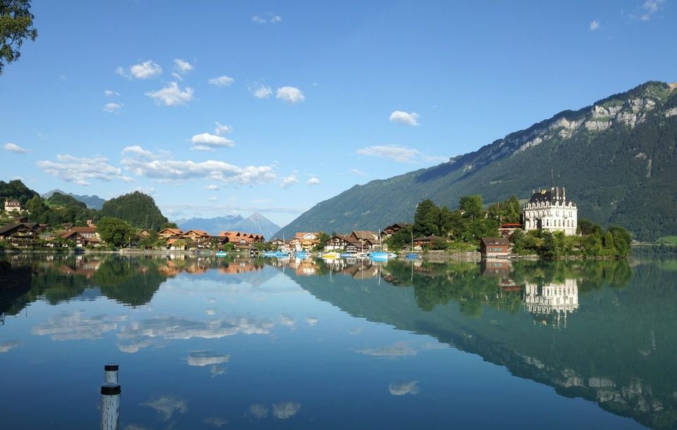
Our verdict
The lakeside path between Iseltwald and Giessbach is graded easy: 5.36 km in about 1 h 30. Walk it from Iseltwald and take the boat back from Giessbach See while boats run, until 6 December 2026, or start at Giessbach See and walk back to Iseltwald.
The forest path, higher up the slope, runs from Giessbach to Iseltwald: 8.63 km in 2 h 50, fine with an off-road pram, best from May to August.
Skip the full Path of the Three Waterfalls unless you want a whole day: 18.20 km and 5 h 15 from Bönigen to Brienz, when the half from Iseltwald reaches Giessbach in 1 h 30.
Skip the Bättenalp unless you are very fit: 20.04 km, 7 h and 1,391 m up and down, and Interlaken Tourism rates the fitness needed as very difficult.
Skip the lakeside path in winter: no boats run back from 7 December 2026 to 26 March 2027, and Interlaken Tourism marks it best from May to October.
When you can walk around Iseltwald
Interlaken Tourism marks the lakeside path as best from May to October and the forest path from May to August. It marks the Senggflueweg and the panorama route as suitable in every month.
No boats run on Lake Brienz from 7 December 2026 until the spring boats start on 26 March 2027. In winter, walk the Senggflueweg or the panorama route and take bus 103 back from Iseltwald, Dorfplatz. The Giessbach funicular runs Wednesday to Sunday until 6 December 2026.
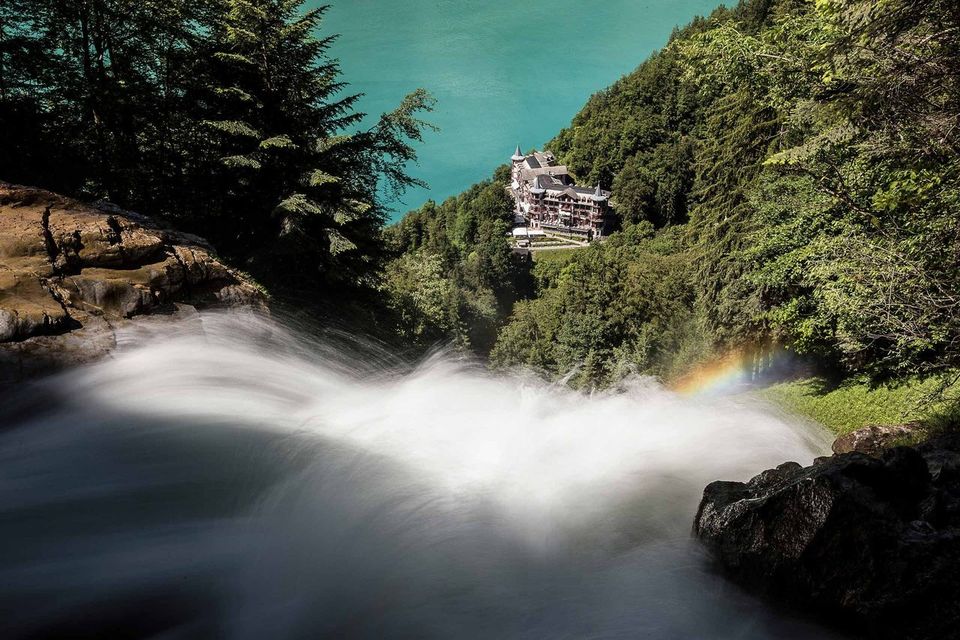
Trail grades and safety
The lakeside path uses only signposted paths of the hiking path category, says Interlaken Tourism. Its kit list:
- Light trekking shoes and a light backpack
- Sun protection and a rain jacket
- A small first-aid kit, a light picnic and enough to drink
- A mobile phone
Interlaken Tourism also warns that Lake Brienz is among the coldest lakes in Switzerland, that some shoreline sections climb moderately, and that at the Glooten picnic area the path climbs a little more.
What we tell our friends
Pierre Vetsch, founder, from days on Lake Brienz with guests. Answers recorded from September to October 2026.
- I have been to Iseltwald myself.
- At Giessbach, my advice: take the funicular up and walk down.
- To miss the crowd, I tell people to come to Iseltwald after 17:00.
- From mid-September I find the lake too cold for an ordinary visitor.
- In winter, what I do not like about Iseltwald is the shade and the cold.
Hiking in Iseltwald: your questions
How do I hike from Iseltwald to Giessbach Falls?
Start at the Iseltwald lido and follow the lakeside path to Giessbach: 5.36 km, about 1 h 30, easy. Come back by boat from Giessbach See, until 6 December 2026.
How long is the Iseltwald to Giessbach hike?
About 1 h 30 for 5.36 km, says Interlaken Tourism, with 20 m of climbing. The municipality gives about 1.5 hours.
Is the Iseltwald to Giessbach hike easy?
Yes. Interlaken Tourism grades it easy: 5.36 km with 20 m of climbing, slight ups and downs, some harder shoreline sections with moderate climbs, and a slightly bigger climb at the Glooten picnic area.
Can you walk from Giessbach back to Iseltwald?
Yes, on the same lakeside path, or on the higher forest path: 8.63 km and 2 h 50 from Giessbach, says Interlaken Tourism.
Can you hike around Iseltwald in winter?
Yes, on the Senggflueweg and the panorama route, which Interlaken Tourism marks as suitable in every month. The lakeside path is best from May to October.
Keep reading
- Iseltwald: our village guide
- Bönigen to Iseltwald
- Giessbach Falls
- The Giessbach funicular
- Where to stay in Iseltwald
- Where to eat in Iseltwald
- Lake Brienz
Sources
- Interlaken Tourism and Bernese Hiking Trails, lakeside path Iseltwald to Giessbach, read 10 Nov 2026
- Interlaken Tourism, forest path Giessbach to Iseltwald, read 10 Nov 2026
- Interlaken Tourism, Senggflueweg, read 10 Nov 2026
- Interlaken Tourism, panorama route Iseltwald, read 10 Nov 2026
- Interlaken Tourism, Path of the Three Waterfalls, read 10 Nov 2026
- Interlaken Tourism, to the Bättenalp from Iseltwald, read 10 Nov 2026
- Municipality of Iseltwald, lakeside path Iseltwald to Giessbach, read 10 Nov 2026
- Municipality of Iseltwald, fire places, read 10 Nov 2026
- Grandhotel Giessbach, getting here, read 10 Nov 2026
- Giessbach funicular, timetable and fares 2026, read 10 Nov 2026
- BLS Lake Cruise, timetables 2026 and 2027, read 10 Nov 2026
- SBB timetable data, read 10 Nov 2026
Field notes: Pierre Vetsch, September to October 2026. Last checked 11 November 2026. Photos: Bönigen-Iseltwald Tourismus and Interlaken Tourismus (CC BY-SA 4.0), Andrea Badrutt for Interlaken Tourismus (CC BY-SA), Sidharthmittal13 (CC BY-SA 4.0, via Wikimedia Commons).
Want to walk to Giessbach and still catch the boat? Tell us your date and we plan the day with you. Ask about a private day

 Grüessech! That's hello in Bernese German. We're Pierre, Teona, Timoté and Olivia, and we all live around Interlaken.
Not sure? Ask a local
Tell us your date and what you like. A local answers on WhatsApp and tells you which free places fit your day. That is free too.