
Gälbe Schopf from Sulwald
3.4 km from Sulwald to Gälbe Schopf, 3 h 30 up, 3 h 30 down.
No booking neededWT3+ (SAC) · About 3 h 30 up, 3 h 30 downPlan itAvalanche terrain: check the SLF avalanche bulletin before you go, or go with a mountain guide. SLF avalanche bulletin ›
A winter walk: This one is on our winter list. Switch to Winter above, or see our summer hikes. Summer hikes ›
Avalanche terrain: check the SLF avalanche bulletin before you go, or go with a mountain guide. SLF avalanche bulletin ›
Quick facts
About this trail
An alpine snowshoe route from the Swiss Alpine Club route portal. It is not signposted or prepared: you need avalanche gear and mountain experience.
Route map
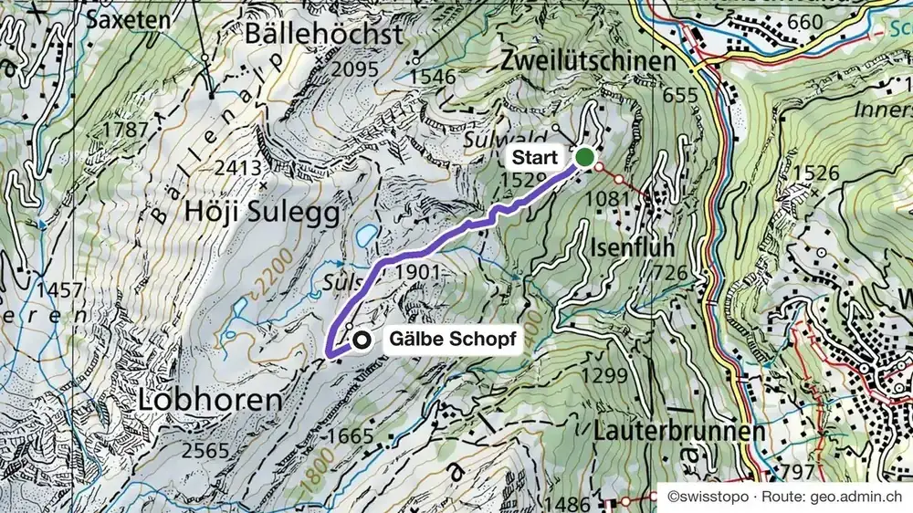
How do I get to the start of the alpine snowshoe route “Gälbe Schopf from Sulwald”?
Ask us on WhatsApp: we tell you the best way there.
Trains, buses and lifts: check the timetable in the SBB app on the day. Trails close after storms and heavy snow.
Good to know
Before you go
Can I do it?
- Level: WT3+ on the SAC snowshoe scale
- Gear: Only with mountain experience. It is an alpine snowshoe route, not signposted or prepared: you need avalanche gear, and you check the SLF avalanche bulletin before you go, or you go with a mountain guide.
Gälbe Schopf from Sulwald: quick answers
How long is the alpine snowshoe route “Gälbe Schopf from Sulwald”?
3.4 km, about 3 h 30 up, 3 h 30 down, with 676 m up.
Can I do the alpine snowshoe route “Gälbe Schopf from Sulwald” without a guide?
Only with mountain experience. It is an alpine snowshoe route, not signposted or prepared: you need avalanche gear, and you check the SLF avalanche bulletin before you go, or you go with a mountain guide.
Need a guide?
Want a local with you? Tell us your date and your group. We tell you honestly if we can guide this one, or which trail we would pick for you.
Teona, ski guide and farm tours, lives in InterlakenAsk Teona on WhatsAppMore winter hikes and huts
Mürren, our local guide ›Hikes from Mürren ›
See all hikes and huts