
Bernese Oberland
Hiking in Grindelwald
Trails from the village and from the First, Männlichen, Eiger Express and Pfingstegg lifts.
How do I get there?36 min by train from InterlakenGrindelwald, 36 minutes by train from Interlaken, is a hiking base: lifts take you up to First, Männlichen, Eigergletscher and Pfingstegg, and trails lead along the slopes or back down. The high trails run from May or June to October. On 10 November 2026 the First, Männlichen and Eiger Express lifts are closed for maintenance, and Pfingstegg until May 2027.
Written by Pierre Vetsch, founder and head guide. Last checked 10 November 2026.
Hiking in Grindelwald at a glance
- Trail season: May or mid-June to October, depending on the trail
Männlichen lift company, read 10 Nov 2026 - Lifts closed in November 2026: Eiger Express until 20 November, First until 27 November, Männlichen until 11 December, Pfingstegg until May 2027
Grindelwald Tourism and the lift companies, read 10 Nov 2026 - Pierre's advice: Walk from Männlichen to Kleine Scheidegg, then take the train back
Pierre Vetsch, autumn 2026 - Hiking map: Free at the tourist office
Grindelwald Info Guide, summer 2026
Hikes from First
Of the four hikes at First, the shortest is Grosse Scheidegg to First, 5.6 km in 1 h 40, and the longest Schynige Platte to First, moderate, 16 km in 6 h. Times and grades come from the lift companies, jungfrau.ch and Grindelwald Tourism's summer Info Guide 2026, read on 10 November 2026.
The First gondola leaves from the village centre. The walk to the Bachalpsee, in under an hour from the top station, has its own page: Grindelwald First and the Bachalpsee.
First to Bussalp over the Faulhorn
10 km, 3 h 50Trail no. 2 climbs 548 m past the Bachalpsee to the Faulhorn, then drops 909 m to Bussalp. In 2026, bus 126 ran to Bussalp from 17 May to 18 October.
First to BussalpMap ©swisstopoSchynige Platte to First
Moderate, 16 km, 6 hThe high trail over the Faulhorn: 835 m up and 629 m down from Schynige Platte, or the other way from First. The jungfrau.ch hike ticket includes the trip back. The Schynige Platte railway ran from 13 June to 25 October in 2026.
Schynige Platte to FirstPhoto: Whgler, CC BY-SA 3.0Grosse Scheidegg to First
5.6 km, 1 h 40Trail no. 6 climbs 270 m from the pass to the First top station. In 2026, bus 128 ran to Grosse Scheidegg, 35 minutes, from 17 May to 18 October.
Grosse Scheidegg to FirstPhoto: Tinelot Wittermans, CC BY-SA 3.0Alpenrosenweg, First to Bort
Easy, 7.97 km, 2 h 30Down 820 m from the First top station to Bort, where you can take the gondola back down.
The AlpenrosenwegMap ©swisstopo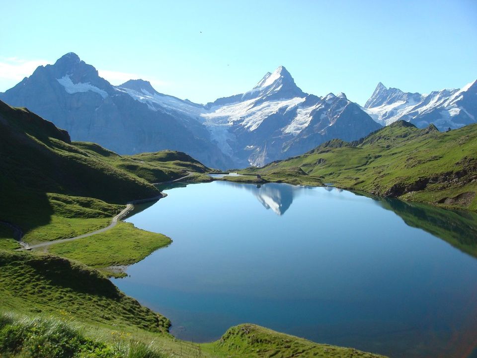
Our verdict
Three summer walks start from the lifts: First to the Bachalpsee, under an hour, and on over the Faulhorn to Bussalp, 10 km in 3 h 50; the Eiger Trail under the north face, 6.1 km in 2 h, 78 m up and 779 m down; and the Panorama Trail from Männlichen to Kleine Scheidegg, 4.5 km in 1 h 20.
With children, the Lieselotteweg from Männlichen has 13 posts for children on the way down to Holenstein, 3.5 km in 2 h 30.
Skip Schynige Platte to First unless you have a whole day and strong legs: 16 km, 6 h and 835 m up. Skip the steep Weid path down from Pfingstegg too: the lift company calls it short but challenging, ideal for experienced hikers; the forest road via Sulz takes 1 h 10.
Until 20 November 2026, none of the four lifts on this page runs: the Eiger Express is closed from 9 to 20 November, First until 27 November, Männlichen until 11 December and Pfingstegg until 5 May 2027.
Hikes from Männlichen and Holenstein
The gondola from Grindelwald Terminal reaches the Männlichen top station in 19 minutes. Times from the Männlichen lift company.
Panorama Trail, Männlichen to Kleine Scheidegg
4.5 km, 1 h 20Past Honegg and Rotstöckli to Kleine Scheidegg, mid-June to October. Pierre's advice: walk it, then take the train back.
The Panorama TrailPhoto: Timo Newton-Syms from Helsinki, Finland & Maidenhead, Berkshire, UK, CC BY-SA 2.0Royal Walk
2 km, 25 min upFrom the top station to the Männlichen summit and back: 25 minutes up, 15 down. May to October.
The Royal WalkMap ©swisstopoLieselotteweg, Männlichen to Holenstein
3.5 km, 2 h 30Trail no. 30 drops 608 m to the Holenstein middle station, with 13 posts for children. June to October.
The LieselottewegMap ©swisstopoRomantikweg, Männlichen to Alpiglen
7.2 km, 2 h 15Down through alpine meadows to Alpiglen. June to October.
The RomantikwegMap ©swisstopoÖpfelchüechliweg, Holenstein to Brandegg
4.7 km, 1 h 30Ends at Brandegg, whose restaurant bakes apple cakes every day. May to October.
The ÖpfelchüechliwegMap ©swisstopoThe Eiger Trail, under the north face
Eiger Trail, Eigergletscher to Alpiglen
6.1 km, 2 hTrail no. 36: 78 m up and 779 m down along the foot of the north face. The Eiger Express takes you from Grindelwald Terminal to Eigergletscher in 15 minutes.
The Eiger TrailMap ©swisstopo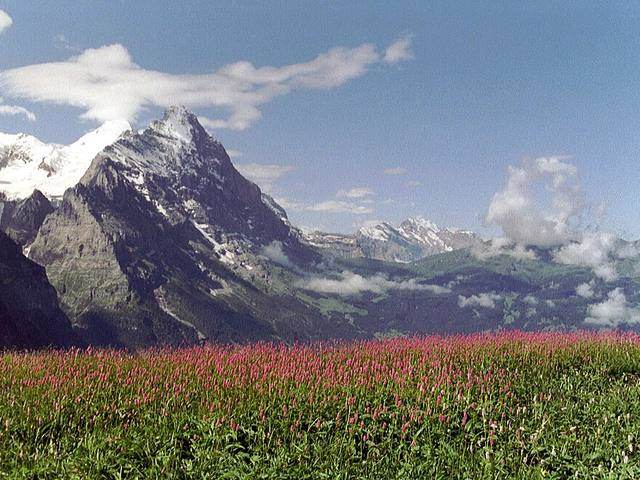
Hikes from Pfingstegg
The Pfingstegg cable car climbs from the south edge of the village in less than 5 minutes. Times from the lift company.
- Back down to the village: via Sulz in 1 h 10, on a forest road with a few steeper, rocky sections; via the old marble quarry in about 1 h, short but steep, in good footwear; via Weid in 1 h at most, steep and challenging, for experienced hikers. From Hotel Wetterhorn, trail 21 leads back to the village in 50 minutes.
Pfingstegg to Hotel Wetterhorn
1 hMostly downhill, through the Breitlouwina tunnel to Hotel Wetterhorn and its bus stop. The lift company says sure-footedness and sturdy footwear are essential. Do not stop where rocks can fall.
Pfingstegg to Hotel WetterhornMap ©swisstopoUNESCO trail to Bäregg
1 h 30 one waySeven stops explain the rockfall on the Eiger and the glacier lake below it. Allow 2.5 to 3 hours for the round trip.
Pfingstegg to BäreggMap ©swisstopoWalks from the village, without a lift
Five walks start in the village or end there on foot: the Terrassenweg and the round walk via Pfingstegg, the path out to the Glacier Gorge, the climb past the Abbach waterfall to Bussalp, and Via Alpina stage 11 to Lauterbrunnen. Each trail page gives the distance and the climb.
Terrassenweg
Loop from the villageA round walk that starts and ends in the village.
The TerrassenwegMap ©swisstopoTo the Glacier Gorge
Loop from the sports centreOut to the Glacier Gorge and back.
The Glacier Gorge loopMap ©swisstopoGrindelwald to Bussalp
Up from the villagePast the Abbach waterfall to Bussalp.
Grindelwald to BussalpMap ©swisstopoGrindelwald round walk via Pfingstegg
Loop from the villageUp via Halten to Pfingstegg and back down via Sulz.
The Pfingstegg loopMap ©swisstopoVia Alpina, stage 11
Grindelwald to LauterbrunnenThe long walk over to the Lauterbrunnen Valley.
Via Alpina, stage 11Map ©swisstopoWhen you can hike around Grindelwald
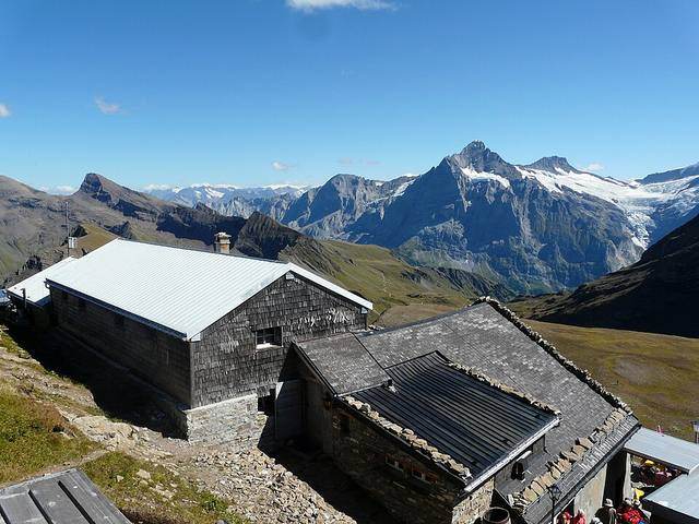
The high trails are summer trails: from May or mid-June to October, says the Männlichen lift company, and Pfingstegg opens its trails as snow and weather allow. Pierre's best summer month here is July.
On 10 November 2026: the Eiger Express is closed until 20 November, the First gondola until 27 November and the Männlichen gondola until 11 December. Pfingstegg closed for the winter after 22 October and reopens on 5 May 2027. The Glacier Gorge closed in early November. Berghotel Faulhorn and Berghaus Bäregg are closed for the winter.
Trail grades and safety
Grindelwald Tourism separates two kinds of summer trail:
- Hiking trails often run on wide paths, but can be narrow and uneven.
- Mountain hiking trails cover rough terrain and are mostly steep, narrow and partly exposed: you need sure feet, no fear of heights and good fitness.
- In winter, walk only on the winter trails signposted in purple, and heed the avalanche service. After snowfall, the ground can be soft and demanding.
Jungfrau Railways reminds walkers that they hike at their own responsibility and risk. Pick up the free hiking map at the tourist office.
Winter walks from Grindelwald
The winter trail from First to Bort takes 3 hours, with stops at Berggasthaus First, Waldspitz and Bort, and a side trip to the Bachalpsee. Berggasthaus First is closed until 27 November 2026, and the Alpinhotel at Bort until 17 December.
Pierre has walked the winter path from Männlichen to Kleine Scheidegg on snowshoes, in about 1 h 30. Grindelwald Tourism's winter Info Guide 2026/27 gives 2 h 45 for this 6 km winter trail. The Männlichen lifts reopen on 12 December 2026.
The Winter Hiking and Sledging Pass costs CHF 61 a day for adults aged 20 and over on low-season weekdays, and CHF 64 at weekends and in high season (19 December 2026 to 3 January 2027, 30 January to 28 February 2027). It is on sale from 21 November 2026 to 25 April 2027. Snowshoe trails and rental: Snowshoeing in Grindelwald.
One winter walk ends on a sledge: about two and a half hours up from First to the Faulhorn, then the Big Pintenfritz run. The Faulhorn.
What we tell our friends
Pierre Vetsch, founder. He skis in Grindelwald every Tuesday in winter and guided at First in August 2026. Answers recorded from October to November 2026.
- My best month for summer in Grindelwald is July.
- Walk from Männlichen to Kleine Scheidegg, then take the train back.
- In winter I walked from Männlichen to Kleine Scheidegg on snowshoes, in about 1 h 30. At the end of the day the light turns pink and the moon is out.
- On snowshoes, I have done the Wetterhorn loop and the trail from Bussalp down to Bort.
Hiking in Grindelwald: your questions
What is the best hike in Grindelwald?
We do not rank them. Pierre's advice: walk from Männlichen to Kleine Scheidegg, 4.5 km in 1 h 20, then take the train back. For a full day, the trail from First over the Faulhorn to Bussalp takes 3 h 50.
What are the best Grindelwald First hikes?
The Bachalpsee, under an hour from the top station; on over the Faulhorn to Bussalp in 3 h 50; the Alpenrosenweg down to Bort in 2 h 30; and the 6-hour trail to Schynige Platte.
Are there hikes in Grindelwald without a cable car?
Yes. You can walk up to Pfingstegg from the valley station in about an hour, and the Terrassenweg loop starts in the village. From Hotel Wetterhorn, reached by bus, trail 21 leads back to the village in 50 minutes.
How long is the glacier canyon walk in Grindelwald?
1 to 2 hours, says Grindelwald Tourism. The gorge is closed in winter: in 2026 it closed in early November.
How to get to Eiger Trail from Grindelwald?
Take the Eiger Express from Grindelwald Terminal to Eigergletscher in 15 minutes, then walk down to Alpiglen in about 2 hours. It is in Grindelwald Tourism's summer guide, and the Eiger Express is closed from 9 to 20 November 2026. The trail called Eiger Trail in the winter guide is another route: a snowshoe trail from Holenstein to Brandegg.
Is there a walk from Grindelwald to Lauterbrunnen?
Yes: stage 11 of the Via Alpina links the two on foot. The train is quicker: 39 minutes, with a change at Zweilütschinen, on the SBB sample for 20 January 2027.
Can you go winter hiking in Grindelwald?
Yes, on trails signposted in purple. From First, a 3-hour winter trail leads down to Bort, but the First gondola is closed until 27 November 2026: check the trail status on jungfrau.ch before you go.
Is hiking in Grindelwald good in May?
Partly. Pfingstegg reopens on 5 May 2027, and the Royal Walk and the Öpfelchüechliweg at Männlichen run from May. The Panorama Trail waits until mid-June.
Keep reading
- Grindelwald: our village guide
- Grindelwald First
- The Faulhorn
- Hotels in Grindelwald
- Where to eat in Grindelwald
- Hiking in Wengen
- The Pfingstegg cable car
- Männlichen cable car
Sources
- Grindelwald Tourism, Info Guide summer 2026 (PDF), read 10 Nov 2026
- Grindelwald Tourism, operating hours of service providers (PDF), read 10 Nov 2026
- Grindelwald Tourism, winter hiking, read 10 Nov 2026
- Jungfrau Railways, Schynige Platte to First, read 10 Nov 2026
- Jungfrau Railways, hiking, read 10 Nov 2026
- Jungfrau Railways, winter hike First-Waldspitz-Bort, read 10 Nov 2026
- Jungfrau Railways, Winter Hiking and Sledging Pass, read 10 Nov 2026
- Jungfrau Railways, Eiger Express and Grindelwald Terminal, read 10 Nov 2026
- Männlichen lift company, Panorama Trail, Royal Walk, Lieselotteweg, Romantikweg, Öpfelchüechliweg, read 10 Nov 2026
- Pfingstegg cable car, hiking and cable car, read 10 Nov 2026
- Interlaken Tourism, Alpenrosenweg, read 10 Nov 2026
- SBB timetable data, read 10 Nov 2026
Field notes: Pierre Vetsch, August to November 2026. Last checked 10 November 2026. Photos: Robert Campbell (CC BY 2.0), Timo Newton-Syms (CC BY-SA 2.0), Ryan Gsell (CC BY 2.0), Tinelot Wittermans (CC BY-SA 3.0), Whgler (CC BY-SA 3.0), via Wikimedia Commons.
Want a local to pick the right trail for the weather on your day? Tell us your date. Ask about a private day

 Grüessech! That's hello in Bernese German. We're Pierre, Teona, Timoté and Olivia, and we all live around Interlaken.
Not sure? Ask a local
Tell us your date and what you like. A local answers on WhatsApp and tells you which free places fit your day. That is free too.